Space Needle to Mercer Island
 I've never done a loop of Mercer Island and I've been told that it was a nice ride. I chose to start from the Space Needle because I figured this would be a
 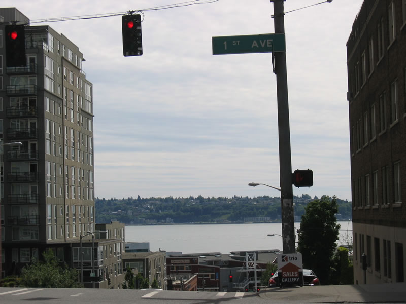 good route if someone wanted to go through some of the more scenic areas of Seattle. If you're getting there by car, there is a parking lot right on the corner of Broad St. and 4th Ave N.
Broad Street is pretty busy with traffic during the week, but not bad during the weekend. However, as there is no bike lane, it is a bit hairy until you get down to Western Ave. Along the way, you'll see a nice view of Puget Sound. It's less than half a mile to get down to Western Ave. Heading SE
 now, there's still no bike lane, but there isn't that much traffic on this road, even during the week. And you get really nice views of the Sound here. There's a cruise-ship terminal along the way and
 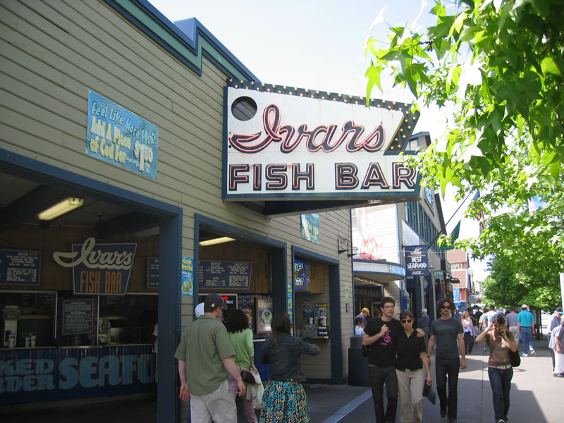 about a mile or so down you'll start to see more waterfront stores instead of warehouses. Ivar's has very good fish.
Once you get past the ferry terminal, about 5 blocks down you'll see Main St, and two more blocks down King St. If you take the former, you'll go through parts of Pioneer Square, which I think is where the city was
 originally established. There are a number of really nice brownstones there. I took King Street to get a view of Qwest Field, a.k.a. Seahawks Stadium. Either way, you'll hit 2nd Ave. Extension, where you'll take a right. One block down, it merges into 4th Ave. S. This road is pretty dangerous, so take the sidewalk if you're not comfortable.
 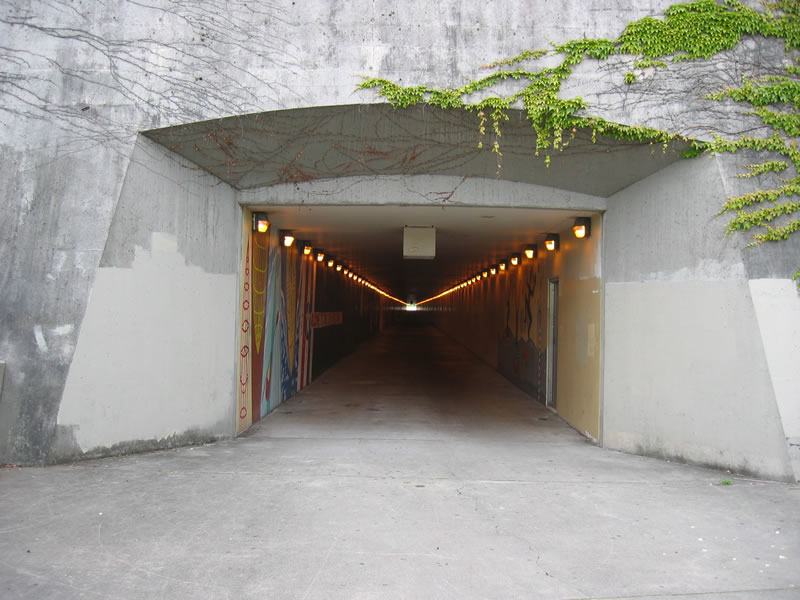 Less than 1000 feet down at the second light, take a left on Airport Way South, then another left at the next light on S. Dearborn St. There's a bike lane here. Continue straight for about .75 miles. At the big intersection with Raineer Ave., keep going straight. Take the first right at Hiawathe Pl. Two blocks down in S. Bush Place. T
 ake a right and get on the sidewalk on the left side. This is actually a bike path that goes uphill toward the I-90 bike tunnel. You'll first cross 23rd Ave S. and then another street (MLK Jr. Way?). Keep on the bike path until you reach the tunnel. After leaving the tunnel head downhill and you'll be on the I-90 floating bridge that will get you to Mercer Island! The ride along the highway is loud, but it almost feels like you're biking on water. And the views of Lake Washington and the Cascade Mountains are pretty spectacular.
Once over the bridge, I took an immediate left and another left that took me under the highway. I was now on 60th Ave S. The ride around the island is not entirely traffic-free, but much better than in Seattle-proper. There are only a few really nice panoramic views of Lake Washington along the way. That's why I stopped at the first park (called Slater Park) only 3 or 4 streets down from the highway. The park is very small and so is easy to miss. It leads down to the water where you can get a nice glimpse of the I-90 bridge and Seattle beyond it.
 Another street down and the road takes a left turn and then hits W Mercer Way. Take a right and the rest of the ride on the island is on the same road until you cross I-90 again on the NE side of the island after a 3/4 loop. Along the way, you'll mostly see nice houses and cars. The scenery is nice and the ride enjoyable; you'll probably see other bikers along the way. The ride is hilly and you'll be going up and down frequently, although never above 300 feet or so.
Once over I-90, take a left on the bike path. About 500 feet down, you'll hit N Mercer Way. You
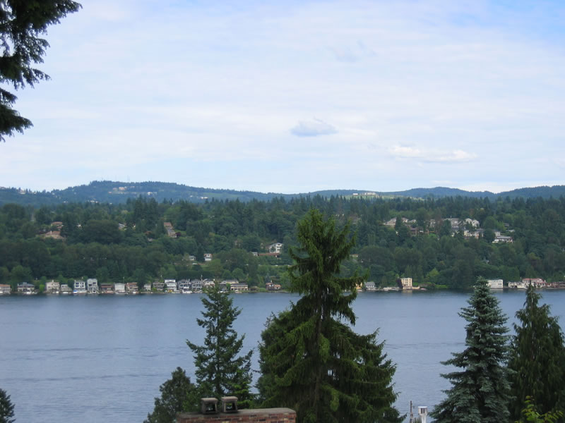
 can keep on the bike path, but I chose to ride on the road because I wanted to check out Luther Burbank Park on the north end of the island. If you keep on N Mercer Way, it'll turn into 84th Ave S. about a mile down. On the right side there is the south entrance of the park, which I took. There's a parking lot here and a path that goes to the lake, but the view isn't great, so I went back up to 84th Ave S. and continued north to the end of the street. There's another parking lot and if you take the north path/walkway, it'll lead you to the edge of the water, where you can get a really nice view of Washington Lake, Seattle, and Bellevue.
 Heading back uphill, take a right on SE 24th St. and another right on 80th Ave SE., where it's pretty hilly. Turning left on SE 22nd St will lead you to an intersection with N. Mercer Way. where in a short time you'll hit the bike path that takes you back to the I-90 bridge. From then on, I took the same way back, except I chose to go through downtown instead of by the water. At the 4th Ave./2nd. Ave. Extension, I kept going straight on 4th Ave. This road is full of cars on any day so you have to be really careful. I found that it's best to keep on the left side of the street, because the right side is full of buses. This is definintely the most dangerous part of the whole ride, but you get to see some pretty big skyscrapers :-). 4th Ave. leads directly back to the Space Needle about 2 miles down.
 Total: 27.8mi Bike Ride
[Backdated on 06/08/2006]
[07/12/2006 - NOTE - I finally got the Google Map to work!
posted by Severe Training at 8:40 PM
![]()
![]()
1 Comments:
Just want to say thanks for the directions from King Street to the Mercer Island bridge. Last Saturday (3/22/08)I put myself and my bike on a bus from Vancouver, BC to Seattle, got off at King Street Station, got on my bike and rode to my parents' house in Bellevue. I always wanted to ride across that bridge and finally did it. Your directions made it extremely easy to get to the tunnel. Thanks again, Louis Chirillo
Post a Comment
<< Home