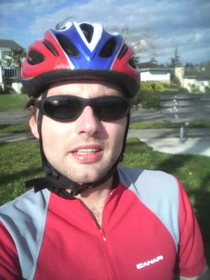
I finally went back to my old stomping ground: the Elliot Bay area near Belltown and Myrtle Edwards Park. I've been delaying a really long run for a while now and today seemed like the perfect day because yesterday I only ran 3 miles and the weather couldn't be any better.
I started out near a parking lot near Pier 70 I think on 16th Ave. W. It's right by the water. To get there you have to get on the bridge at the intersection of Elliot Ave. W. and 14th Ave. W. to cross the train tracks. That's the only free parking lot I know of that gives easy access to Myrtle Edwards Park (the ones near Belltown charge a fee). Anyway, you can figure out how to get there on the map.
I started by going north away from Elliot Bay and made a semi-circle to get to the marina. I turned around and decided to head north all the way to Discovery Park. I've biked this way before, but I've never run it. Once I got there, I made a loop on the dirt path around the park. Going back, I took a different route through Magnolia. This is a very scenic route--there are really nice houses in this area, and more importantly, awesome views of the bay and downtown Seattle. I made my way down Magnolia Bridge, crossed the tracks (if you go this way, be really careful as there are trains passing by often), and ran back towards my car where I got my first drink. This was right about 13 miles into the run. I came across two water fountains along the way before that (Discovery Park and Magnolia Park) but they weren't working, so I actually stopped and drank from a bottle I had in my car. I did take two gel packs which I used at miles 8 and 12.
Continuing on, I ran through Myrtle Edwards Park to the Olympic Sculpture Park and turned around. The distance was exactly 16 miles. I really don't think I could have gone any longer; otherwise, I would have ran 18. After 13 miles, my whole body was aching and my cardiovascular condition wasn't good either by this point. So, I still have a lot more work to do, but this was still a successful run, especially considering that the course was very hilly.
I wish I had a tiny camera with me that wouldn't bother me while I'm running. I only took one picture with my cell phone before I started running. This was a beautiful course--I highly recommend either running or biking it.

Total: 16.0mi Run; (2:08:03; 8:00 min./mi. pace; 1923 cal.; 148 lb.)

2 Comments:
Hi. I'm a random strager and I stumbled upon your blog becuase I am trying to insert gpsvisualizer maps into my blog and am having difficulty figuring out how I need to chop up the HTML to make things work right. You seem to have it down. Could you let me know what you did to make the map work?
Thanks,
Tom
Hi, I looked at your blog and it looks like you got it to work, but I'll put up a tutorial shortly for others. In the meantime, if you need additional help, see this post.
Post a Comment
<< Home